|
Backcountry Xcursion Routes are provided by the Ministry of Wild on the Path Adventure Projects and provides Men's and Family Events. It is an opportunity for fellow adventures to enjoy a community of folks who desire to thrive as leaders personally, in their tribe, and those around them.
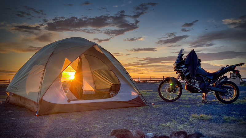
THIS ADVENTURE CHALLENGE. This Event will be held May 15-19-2024. We call it a 'run what ya brung' event and we mean it! The event is for men who love discovery, exploration, new experiences, community, and the pursuit of God's heart. So, it is open to all levels of wildness! You can camp in tents, rv's, in a hammock, or off the back of a motorcycle but you don't need a motorcycle to be a part of this! You might be the guy who sleeps in his car, or right on the ground. It's all good! Every evening after a day of Xploration we'll have a meal and fellowship around the fire and challenge ourselves to be better leaders in our lives, homes, and communities. Below you will find all the information you need to be a part of this Wild on the Path experience. Click the overview map to the Left for information on our destination.
First you must immediately call Crystal Crane Hot Springs to secure your campsite. See the Resort Layout Map here! It is important to secure a spot immediately! I Have already secured Space #1 in the Dry Camping area! They also have overflow camping just behind the dry camping area. it can be seen in the Resort Layout Map in the link above. Once you have secured a Camp spot, Register from the link below and select the 4-5 Day All Events ea. Self-Guided/Web Pkt when you register. Cost $150. Your donation goes directly to the support of Wild on the Path ministries such as this. You can find out more about our Fireside Challenges for men by clicking on the banner to the left.
|
May 15-19-2024Mileage: Total miles 362.0 Motorcycle Route • Faster & Shorter Route for Trucks Campers, RV.
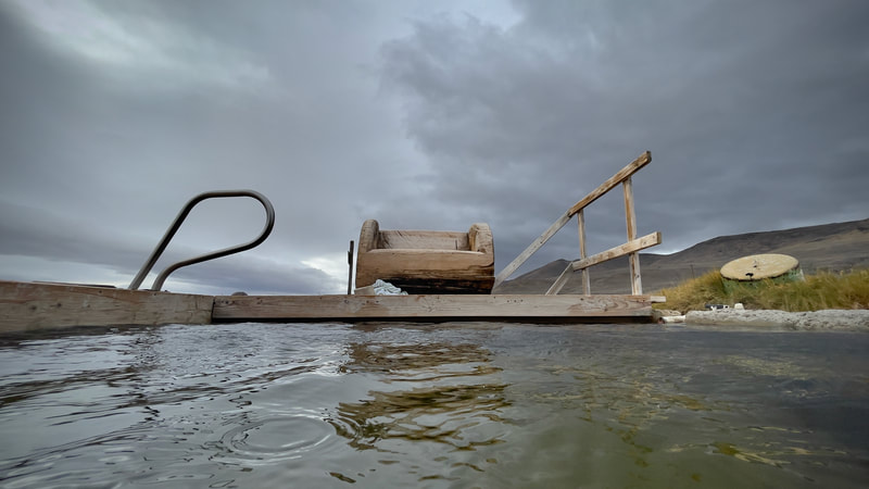
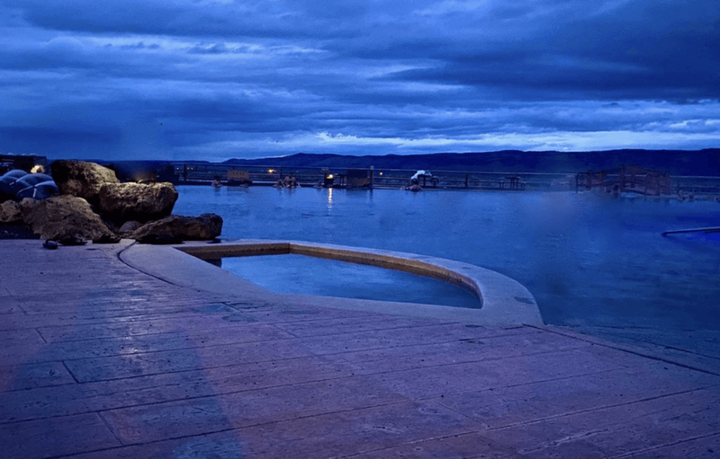
Campground: Crystal Crane Hot Springs Fuel: Fueling Points are available along on Hwy 97 at the Crater Lake Junction Travel Center, Christmas Valley, Riley, Hines, Burns, and Crane. Dinner: In Camp • Whatever you brought! Some will be doing Dry meals. and the resort has beverages. There is a gas Station with a small store and Diner that serves breakfast and lunch that closes at 5:00pm. Burns and Hines have restaurant opportunities or you can cook over your gas stove or open fire. Itinerary. The Schedule is loose! Designed for aspects of Exploration, Relaxation, Recreation, Restoration, and Community. Highlights: Located in the heart of Harney County, Oregon, Crane Hot Springs offers an unforgettable experience you won't find anywhere else! The plan is to soak in the Hot Springs that evening or relax in your camp. There's something for everyone at Crane Hot Springs! See additional information below! Need to Know: Every evening after a day of Xploration we'll do dinner around the fire and a fireside challenge for our group that is focused on becoming better leaders in our personal lives, homes, and communities. Departure Time: 7:00 am • Black Rock Coffee in Medford, OR Day 1: This is a travel day to Crane Hot Springs and to set up our Camp. From white City it is 302 miles. Depending on what you drive this is between a 4.5- to 5.5 hour trip so plan accordingly. Motorcycles and Autos and Rv's will be travelling in separate groups or individually. Day 2-4: To the right of your screen are multiple BXR (Backcountry Xcursion Routes). Click on them to open Google Maps on your phone or your vehicle's Apple or Android Car Play. Day 5: Directions to the Rogue Valley • Home From Crystal Crane Hot Springs Highlights: Located in the heart of Harney County, Oregon, Crane Hot Springs offers an unforgettable experience you won't find anywhere else! Eastern Oregon's vast desert,sage and grasslands are home to the Malheur National Wildlife Refuge, Steens Mountain and the Alvord Desert as well as one of the country’s largest ponderosa pine forests, Harney County has no shortage of environments to explore. Burns is your jumping off point for Eastern Oregon, with hotels, markets and sporting goods. From there it’s just a short drive south along the High Desert Discovery Scenic Byway to Steens Mountain, one of Oregon’s most iconic ranges and home to an abundance of wildlife and miles upon miles of hiking and two-wheeled exploration. To the west of the mountain the Malheur Refuge teems with activity from resident wildlife and the scores of birds that make an annual migratory stop. The Peter French Heritage Site and the Diamond Craters are must see destinations also! See additional information below!
Need to Know: Every evening after a day of Xploration we'll do dinner around the fire and a fireside challenge for our group that is focused on becoming better in our walk with Jesus and leaders in our personal lives, homes, and communities. Departure Time: 7:00 am • Black Rock Coffee in Medford, OR |
ADDITIONAL INFORMATION:
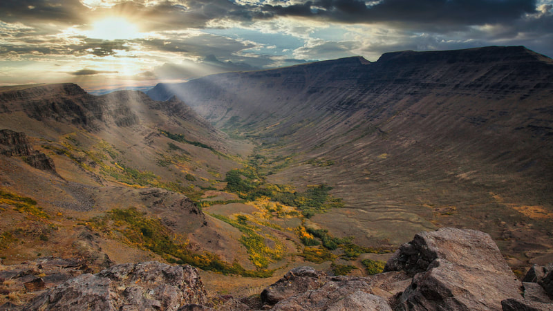
The Steens Mountains consists of 428,156 acres of public land offering diverse scenic and recreational experiences. It ncompasses an extraordinary landscape with deep glacier carved gorges, stunning scenery, wilderness, wild rivers, a rich diversity of plant and animal species, and a way of life for all who live there. The 52-mile Steens Mountain Backcountry Byway provides access to four campgrounds and the views from Kiger Gorge, East Rim, Big Indian Gorge, Wildhorse and Little Blitzen Gorge overlooks are not to be missed! Welcome to the CMPA and enjoy the many resources and activities awaiting you. Congress designated the Steens Mountain Wilderness in 2000 and it now has over 170,200 acres. All of this wilderness is located in Oregon and is managed by the Bureau of Land Management. Steens Mountain is located in Oregon's high desert is one of the crown jewels of the state's wildlands. It is some of the wildest and most remote land left in Oregon. Opportunities for recreation on Steens Mountain are as plentiful as they are widespread. Popular activities include camping, picnicking, sightseeing, and exploring the open country on foot and horseback. Hiking is available in all areas and trailheads exist near Page Springs and South Steens Campgrounds, as well as Wildhorse Overlook and Pike Creek. Visitors photograph landscapes, wildlife and wildflowers, and catch redband trout in the Donner und Blitzen River. Others enjoy hunting for wild game and visiting special places, cross-country skiing, and snowshoeing.
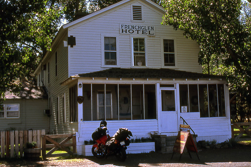
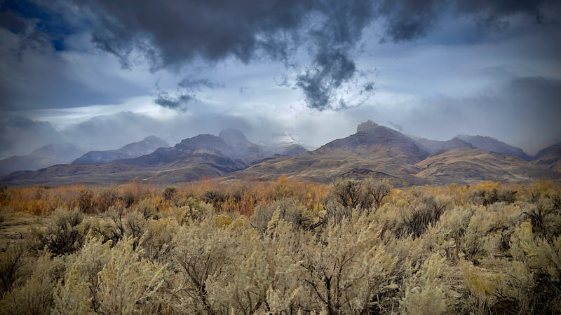
The Alvord Desert is a mysterious and remote desert located in southeastern Oregon. With its vast open spaces and scenic mountain views, the Alvord Desert is a captivating destination for those looking for an off-the-beaten-path adventure. From its wildlife to its hot springs, the Alvord Desert has something for everyone. Located in Harney County, Oregon, and tucked into the Steens Mountain rain shadow, the Alvord Desert is one of the most isolated and unique land formations in the state. With some areas only receiving 5 inches of annual precipitation, it is also one of the driest locations in Oregon. The Alvord Desert was once a giant lake extending 100 miles from end to end with an estimated depth of 200 feet, a robust headwaters of a Snake River tributary. Today, the primary portion of this alkaline flat desert is roughly 20 miles long and 7 miles wide, and it is dry from July to November. Interestingly, several endemic fish species remain in two isolated bodies of water, Borax Lake at the desert's southern edge, and Mann Lake located just north of the desert's flat basin. Flanked to the west by the 1-mile high Steens Mountain escarpment, the desert is located over a tectonic fault that has produced the uplift of the Steens Mountain fault block and numerous geothermal springs. Five notable springs located around the perimeter of the desert include Mickey Hot Springs, Alvord Hot Springs, Tule Springs, Buckbrush Springs and Borax Lake + Hot Springs, though Alvord Hot Springs is the only spring suitable for soaking. Note: Vehicular traffic and hiking is permitted throughout the desert on public lands managed by the Bureau of Land Management, and driving on the flat is only advised during the dry season (July through November). Be sure to fill up on gas before heading out to the Steens Mountain and Alvord Desert area. Year-round gas stations are in Burns and Fields, Oregon. The gas station in Frenchglen is only open during the summer months. Further, cell phone reception is virtually nonexistent in much of the area, so travel with extra provisions. If you plan to explore the area extensively, we highly recommend bringing additional, full gasoline canisters to ensure that you don't get stranded. Also, note that heavy rains can transform areas that are off road into thick, sticky mud that can easily detain even four-wheel drive vehicles; indeed, some dirt roads also need time to firm up before they are passable. Be aware and drive cautiously following heavy storms.
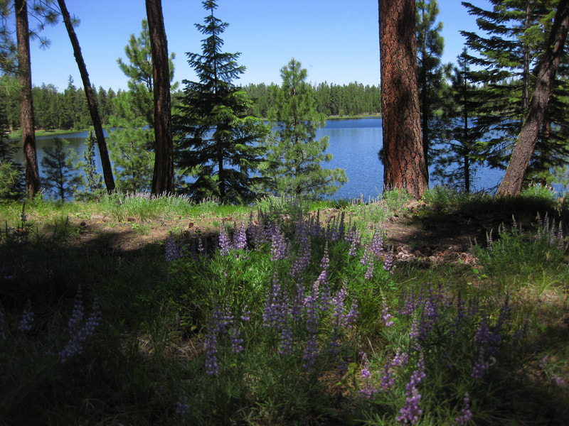
Delintment Lake is small lake in the Ochoco National Forest, Delintment Lake is a remote canoe getaway surrounded by tree-lined banks. The lake is stocked every year for fishing and there are two campgrounds on the banks of the lake. The location is very remote and thus a very peaceful escape.
The Owyhee Canyonlands is a place that radiates with magic. Here, ancient lava rock erodes into honeycombs and lush sagebrush blooms from gnarled branches. Mysterious thundereggs and agates can be found embedded into the crust of the desert floor. Rattlesnakes, badgers, grouse and antelope thrive in the unforgiving landscape, often hidden away from human eyes. Hiking, boating or driving through this landscape is a humbling experience. Towering cathedrals of red rock rise triumphantly from the earth, either dwarfing the humans who stand beneath them or fascinating us with their many forms: spires like fingers emerging from the ground, sheer cliff walls, great blobs of eroded mountains. According to geologists, the rock came from volcanic eruptions some 17 million years ago, when an accumulation of magma from the massive Yellowstone hotspot punched through the crust of the Earth. When the thick, sticky magma cooled on the surface it became rhyolite rock and basalt that nature has sculpted over time. One force of erosion is the 280-mile Owyhee River, which runs through Nevada, Idaho and Oregon, feeding into the larger Snake River. A stretch of the lower river was dammed in 1932, creating the Owyhee Reservoir, also known as Lake Owyhee.
Diamond Craters: Oregon's no stranger to volcanoes - the Cascade Range has plenty - but even if you've hiked through lava tubes or up the slopes of dormant mountains, odds are you've never seen anything quite like Diamond Craters. The southeast Oregon scene is less majestic than the Cascades, but it makes up for the lack of grandeur with an intriguing display of volcanic features: a series of craters, cinder cones and calderas that show up suddenly in the otherwise desolate desert landscape. "There is no other place in North America like Diamond Craters," a Bureau of Land Management brochure boasts. "That's the opinion held by scores of scientists and educators who have visited and studied the area." The relatively small attraction features a diverse array of volcanic features, some that may sound familiar and others recognizable only to those with a deeper geological interest. But no matter your experience, it's well worth a side trip on your trip to Steens Mountain or the Malheur National Wildlife Refuge.
Peter French Barn: The Pete French Round Barn stands in the heart of Harney County and remains a monument to one man’s livestock empire. Peter French arrived in 1872 and began amassing land and cattle. By the mid-1880s, his enterprise had grown to 70,000 acres and 45,000 head of cattle. Some claimed he didn’t legally acquire the land or water rights, which prompted land disputes and court cases and added to his controversial reputation. One of the disputes eventually led to his murder in 1897. Although dubbed the ‘Cattle King,” French was the first rancher in the area to put up hay. He also raised thousands of sheep for their wool. The Round Barn was used to train wild horses to pull long wagon trains full of wool, hay and supplies to market in Oregon City. In today’s landscape, this type of barn is unique. But during 1880–1920, round barns became popular in the Midwest where they were promoted as being efficient for progressive methods of farming. The Round Barn is near the Malheur National Wildlife Refuge, a network of wetlands that attract diverse bird and wildlife species. As you drive through the area, take in the sweeping views of the high buttes surrounding the low plains and marshes and the picturesque Steens Mountain towering in the distance.
