

|
|


|

|
|


|
THE COQUILLE WAGON ROAD
THE XCURSION
Driving the Coquille Wagon Road is very much like stepping back in time while retaining its original roadbed and (even better) its original scenery. The return to Cow Creek from Powers, Oregon is just another highlight of the Coquille River Valley. The 1,059 square-mile Coquille River Watershed is the third largest river system in Oregon to originate from the Coast Range. The majority of the Coquille Watershed lies in Coos County, Oregon. The remainder is in Douglas County and a small area of Curry County. The Coquille's three major tributaries--the North (including the East Fork), Middle, and South Forks--join the main stem within a few miles up- and downstream of the town of Myrtle Point and flow into the Pacific Ocean at Bandon. The South Fork Coquille River is a productive salmon and steelhead spawning stream. Coquille River winter steelhead can exceed 20 pounds and are famous for their acrobatics and strong fight! The river is not stocked for trout, but above Coquille River Falls, anglers can pursue wild cutthroat and rainbow trout.
FUEL POINTS AND LOGISTICS
CONSIDERATIONS
Driving the Coquille Wagon Road is very much like stepping back in time while retaining its original roadbed and (even better) its original scenery. The return to Cow Creek from Powers, Oregon is just another highlight of the Coquille River Valley. The 1,059 square-mile Coquille River Watershed is the third largest river system in Oregon to originate from the Coast Range. The majority of the Coquille Watershed lies in Coos County, Oregon. The remainder is in Douglas County and a small area of Curry County. The Coquille's three major tributaries--the North (including the East Fork), Middle, and South Forks--join the main stem within a few miles up- and downstream of the town of Myrtle Point and flow into the Pacific Ocean at Bandon. The South Fork Coquille River is a productive salmon and steelhead spawning stream. Coquille River winter steelhead can exceed 20 pounds and are famous for their acrobatics and strong fight! The river is not stocked for trout, but above Coquille River Falls, anglers can pursue wild cutthroat and rainbow trout.
FUEL POINTS AND LOGISTICS
- Fueling Availability: Should be done prior to leaving Souther Oregon. Medford, OR, Canyonville, OR, Coos Bay, OR, Coquille OR. Grants Pass, OR.
- Fuel and Resting Stops:
- Total Xcursion Distance: 379 mi
- Transportation Method: Motorcycle, Automobile Camper, RV.
- Total Moving Time: 10 h, 34 min
CONSIDERATIONS
- Don't forget camera gear and swim trunks and a towel!
- Thunder storms are always possible. Be Prepared!
PHOTOS & VIDEOS
|
|
|
DAY 1
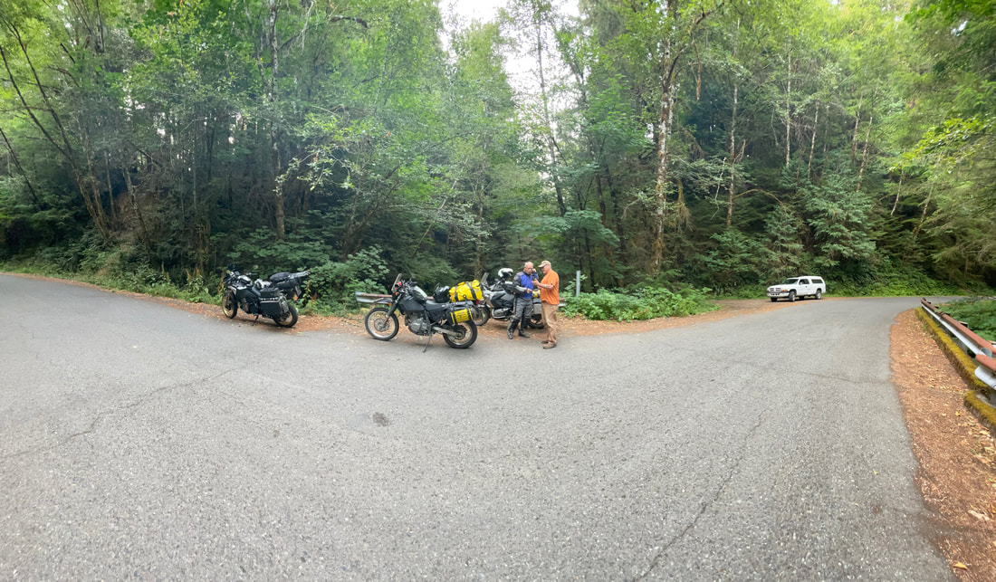
Travels from Jacksonville, Oregon through the Applegate Valley via Ruch, Applegate, Provolt, Murphy and Williams for the start of the day. From Williams take Hwy 260-Riverbanks Road to Merlin, Galice, and over Lower Graves Creek to Wolf Creek Be sure to stop at the Grays Ranch Historical Marker. Henry & Rebecca McMichael were the first to settle this "little meadow” in about 1873. Called "Lonesome Cove Ranch” and later "McMichael Station" by newsmen who stayed while writing about mining. In 1875 Nathaniel McNair established his pack trail from "Yank Ledge", carrying three tons of ore a day, connecting here with trails north and south. With rooms and meals available, it was popular with miners, packers and travelers. After Henry's death, Rebecca married Gebhard Karg in 1887 and continued serving guests. Divorced, she married William Anderson in 1904 and sold in 1906 to George Strong, who ran cattle. Slim & Jean Gould purchased in 1924, then sold in 1930 to Charles "Buster" & Mary Gray. Their descendants are still here today. By 1902, nearly a thousand men worked supporting the mines of Leland, Lower Grave Creek and Mt. Reuben. These mines made some men rich, some broke, and others, merely a living. On the way up Cow Creek make a stop at the West Fork of Cow Creek. You will be exiting here on your return trip. It was a community located deep in the Canyon on lower Cow Creek at the confluence of Cow Creek and the West Fork of Cow Creek. It was created when the Oregon and California railroad (later acquired by the Southern Pacific) first put the railroad through Cow Creek canyon. In addition to a number of railroad section houses, there was a saw mill nearby but the most unique aspect of West Fork was a large hotel. Passengers trains would stop at West Fork and passengers would embark and debark on their way to the Lower Rogue River. Mail was also unloaded at West Fork and was carried by mule team over the Dutch Henry trail and the Mule Creek trail to Mariel on the Rogue River. It was there that the mail and packages were loaded on a boat and taken down the river to the cabins and lodges located along the River all the way to Gold Beach. In the 1950s the third hotel to exist at West Fork was purchased by a consortium of sawmills including Robert Dollar and removed. Each of the previous hotels burned and was replaced. The consortium was called Multnomah Plywood Cooperative and they replaced the hotel with a logging camp for a short time. Soon the logging camp was dismantled and moved and nothing remains of this community except an abandoned gravel pit, memories and a few photographs.
In January 1920 there were 118 people living at West Fork. Thirty-two of those folks were from China and were working on the railroad. At that time the hotel was run by Tim and Winfred Barry. The Barry's were in their early fifties and were Irish descent. Winfred's sister, Annie Sayers also lived there. There were 11 semi-permanent boarders at the hotel in January 1920 and they all worked for the railroad. Some of the more well known visitors/residents of West Fork over the years included Dutch Henry Rosenthal whom the Dutch Henry Trail is named after as well as Zane Grey whom had a cabin on the Lower Rogue River.
After Fueling in Canyonville. It's not far to Tenmile, OR and the East entrance to the box canyon area of the Coquille and the Falls. It is a great place to explore before heading into camp. We recommend staying at Frona County Park.
DAY 2
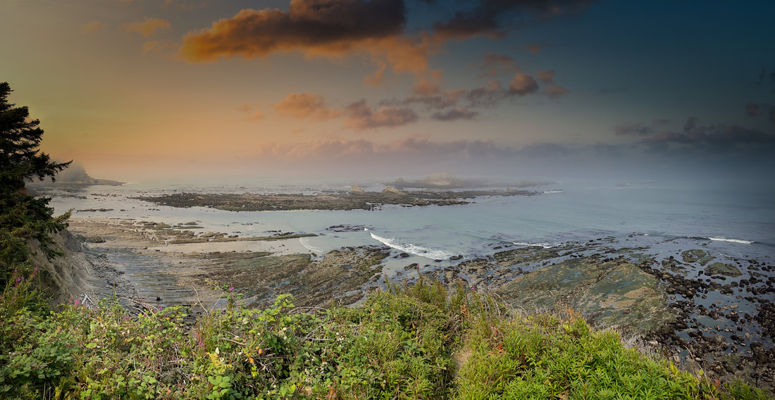
Takes you out for a visit to Shore Acres and Sunset Bay State Park. Just South of Coos Bay, Oregon and the town of Charleston, situated in one of the most scenic areas on the Oregon coast, Sunset Bay State Park features beautiful sandy beaches protected by towering sea cliffs. Only a short walk from the beach, the campground has sites for tent camping and RV's, as well as cozy and comfortable yurts. Day-use and picnic facilities are located along the bay to allow easy access for beachcombing, fishing, swimming, and boating. A network of hiking trails connects Sunset Bay with nearby Shore Acres and Cape Arago state parks. Hiking these trails will give you a chance to experience pristine coastal forests, seasonal wildflowers and spectacular ocean vistas from atop the rugged cliffs and headlands. From points along the trail, you'll be treated to views of Gregory Point and the Cape Arago lighthouse. A public golf course is located next to the park, and the nearby fishing village of Charleston provides opportunities for crabbing, clamming and fishing.
DAY 3
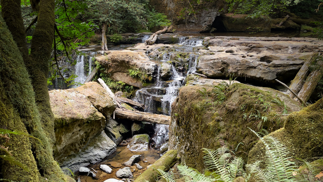
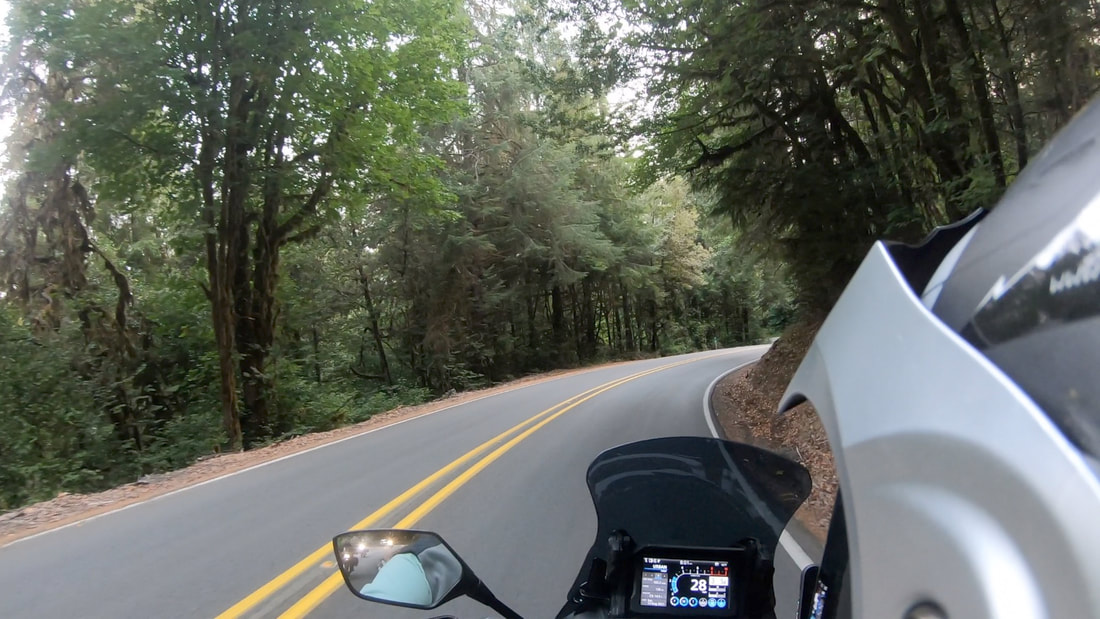
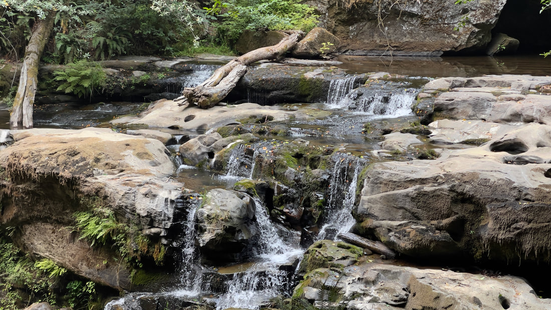
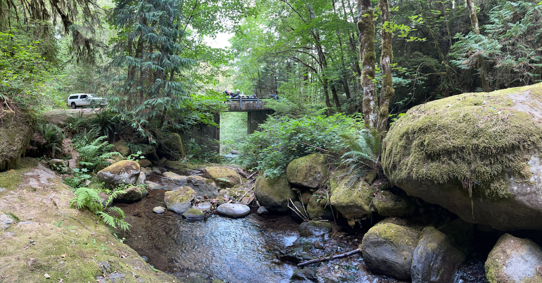
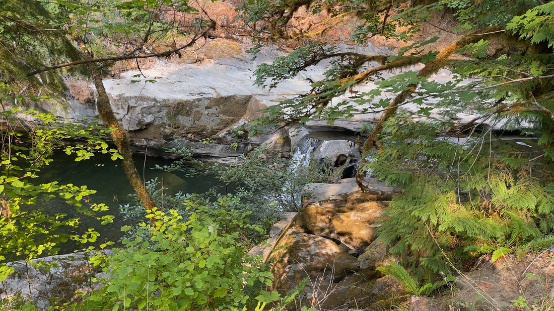
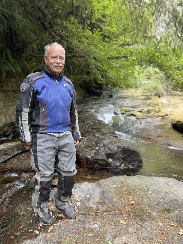
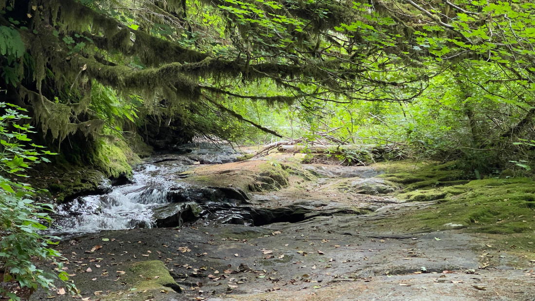
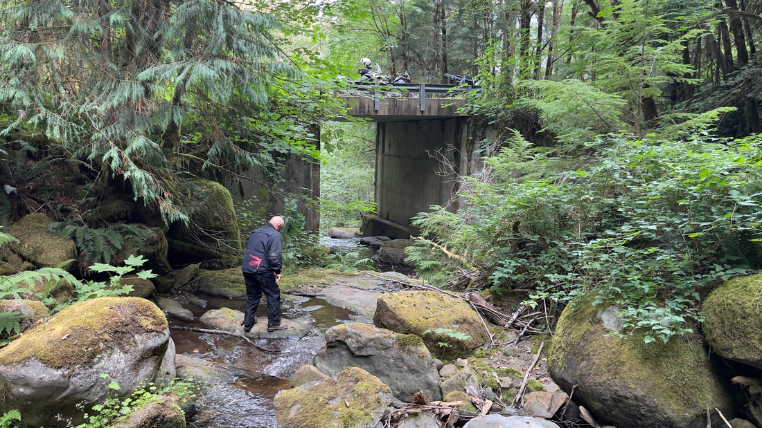
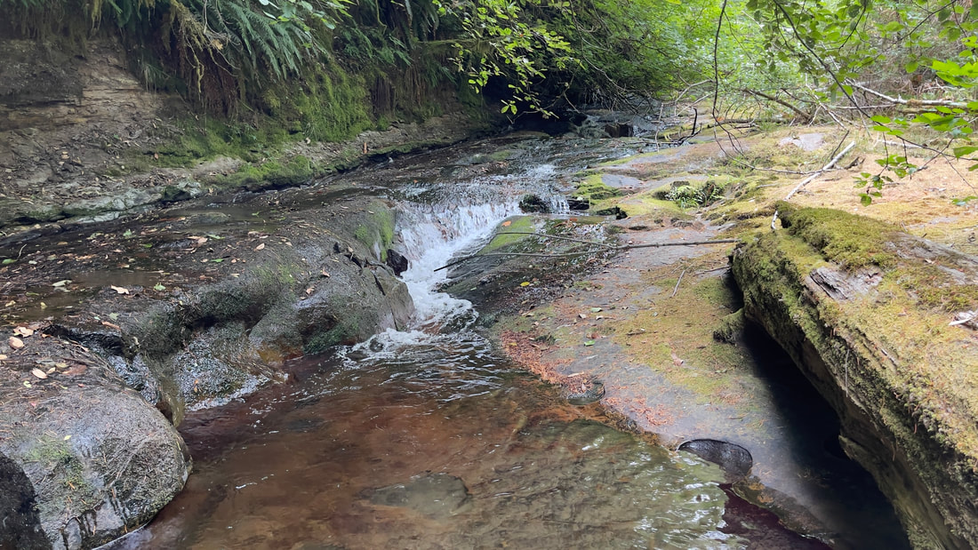
Traveling along the Wild and Scenic Rogue River, the Rogue-Coquille Scenic Byway offers beautiful wooded pathways, geologic formations, spectacular views, and all sorts of outdoor activities, such as hunting, fishing, rafting, and boating. The road takes you past old-growth Douglas fir, Port Orford cedar and other coastal flora, then leads you through a narrow Coquille River canyon guarded by high cliffs and waterfalls. The Coquille River waterfall is one of the most powerful waterfalls in the Oregon Coast Range. The sound of the high-water flow is so loud that a nearby waterfalls was appropriately named "Drowned-Out-Falls". The falls consist of two segmented tiers. The upper tier drops about 45 feet over a wide, uniform ledge, in three distinct block-type waterfalls. The lower tier drops about 65 feet in a pair of concave horsetails. The relatively short Coquille River Falls trail is steep and the trail switches back and forth through an amazing stand of undisturbed old-growth of Douglas-fir, Hemlock, and Port-Orford Cedar trees, and ends at the Coquille River Falls. The falls were named for the river, which is pronounced both "Ko-Keel" or Ko-Kwell after the local Coquille Indian Tribe.
Travels from Jacksonville, Oregon through the Applegate Valley via Ruch, Applegate, Provolt, Murphy and Williams for the start of the day. From Williams take Hwy 260-Riverbanks Road to Merlin, Galice, and over Lower Graves Creek to Wolf Creek Be sure to stop at the Grays Ranch Historical Marker. Henry & Rebecca McMichael were the first to settle this "little meadow” in about 1873. Called "Lonesome Cove Ranch” and later "McMichael Station" by newsmen who stayed while writing about mining. In 1875 Nathaniel McNair established his pack trail from "Yank Ledge", carrying three tons of ore a day, connecting here with trails north and south. With rooms and meals available, it was popular with miners, packers and travelers. After Henry's death, Rebecca married Gebhard Karg in 1887 and continued serving guests. Divorced, she married William Anderson in 1904 and sold in 1906 to George Strong, who ran cattle. Slim & Jean Gould purchased in 1924, then sold in 1930 to Charles "Buster" & Mary Gray. Their descendants are still here today. By 1902, nearly a thousand men worked supporting the mines of Leland, Lower Grave Creek and Mt. Reuben. These mines made some men rich, some broke, and others, merely a living. On the way up Cow Creek make a stop at the West Fork of Cow Creek. You will be exiting here on your return trip. It was a community located deep in the Canyon on lower Cow Creek at the confluence of Cow Creek and the West Fork of Cow Creek. It was created when the Oregon and California railroad (later acquired by the Southern Pacific) first put the railroad through Cow Creek canyon. In addition to a number of railroad section houses, there was a saw mill nearby but the most unique aspect of West Fork was a large hotel. Passengers trains would stop at West Fork and passengers would embark and debark on their way to the Lower Rogue River. Mail was also unloaded at West Fork and was carried by mule team over the Dutch Henry trail and the Mule Creek trail to Mariel on the Rogue River. It was there that the mail and packages were loaded on a boat and taken down the river to the cabins and lodges located along the River all the way to Gold Beach. In the 1950s the third hotel to exist at West Fork was purchased by a consortium of sawmills including Robert Dollar and removed. Each of the previous hotels burned and was replaced. The consortium was called Multnomah Plywood Cooperative and they replaced the hotel with a logging camp for a short time. Soon the logging camp was dismantled and moved and nothing remains of this community except an abandoned gravel pit, memories and a few photographs.
In January 1920 there were 118 people living at West Fork. Thirty-two of those folks were from China and were working on the railroad. At that time the hotel was run by Tim and Winfred Barry. The Barry's were in their early fifties and were Irish descent. Winfred's sister, Annie Sayers also lived there. There were 11 semi-permanent boarders at the hotel in January 1920 and they all worked for the railroad. Some of the more well known visitors/residents of West Fork over the years included Dutch Henry Rosenthal whom the Dutch Henry Trail is named after as well as Zane Grey whom had a cabin on the Lower Rogue River.
After Fueling in Canyonville. It's not far to Tenmile, OR and the East entrance to the box canyon area of the Coquille and the Falls. It is a great place to explore before heading into camp. We recommend staying at Frona County Park.
DAY 2
Takes you out for a visit to Shore Acres and Sunset Bay State Park. Just South of Coos Bay, Oregon and the town of Charleston, situated in one of the most scenic areas on the Oregon coast, Sunset Bay State Park features beautiful sandy beaches protected by towering sea cliffs. Only a short walk from the beach, the campground has sites for tent camping and RV's, as well as cozy and comfortable yurts. Day-use and picnic facilities are located along the bay to allow easy access for beachcombing, fishing, swimming, and boating. A network of hiking trails connects Sunset Bay with nearby Shore Acres and Cape Arago state parks. Hiking these trails will give you a chance to experience pristine coastal forests, seasonal wildflowers and spectacular ocean vistas from atop the rugged cliffs and headlands. From points along the trail, you'll be treated to views of Gregory Point and the Cape Arago lighthouse. A public golf course is located next to the park, and the nearby fishing village of Charleston provides opportunities for crabbing, clamming and fishing.
DAY 3
Traveling along the Wild and Scenic Rogue River, the Rogue-Coquille Scenic Byway offers beautiful wooded pathways, geologic formations, spectacular views, and all sorts of outdoor activities, such as hunting, fishing, rafting, and boating. The road takes you past old-growth Douglas fir, Port Orford cedar and other coastal flora, then leads you through a narrow Coquille River canyon guarded by high cliffs and waterfalls. The Coquille River waterfall is one of the most powerful waterfalls in the Oregon Coast Range. The sound of the high-water flow is so loud that a nearby waterfalls was appropriately named "Drowned-Out-Falls". The falls consist of two segmented tiers. The upper tier drops about 45 feet over a wide, uniform ledge, in three distinct block-type waterfalls. The lower tier drops about 65 feet in a pair of concave horsetails. The relatively short Coquille River Falls trail is steep and the trail switches back and forth through an amazing stand of undisturbed old-growth of Douglas-fir, Hemlock, and Port-Orford Cedar trees, and ends at the Coquille River Falls. The falls were named for the river, which is pronounced both "Ko-Keel" or Ko-Kwell after the local Coquille Indian Tribe.
HISTORY AND INFORMATION
Most folks would naturally make the assumption that the Coquille Wagon Road is much like an old wagon road today. Instead, it remains drivable throughout while retaining its original roadbed and (even better) its original scenery. And what scenery! Mountains, canyons and waterfalls, grass-floored valleys walled in by cliffs, and fine old historic structures dating from the time when this was Coos Bay's only land route linking it to the wide world. It is one of Oregon's finest historic and scenic drives. The Coos Bay Wagon Road goes through the lower section of Brewster Canyon as a paved, single lane road. As one travels fro East to West however, there are short segments of hard packed gravel.
The West's wagon roads are intimately tied to its early railroads. When the transcontinental railroad opened in 1869 people expected it to kill the large and profitable wagon and stage trade, run by companies such as Wells Fargo and American Express. It didn't happen. Instead, the wagon and stage lines congregated around the railheads and created links to the surrounding settlements. This often included upgrading rough tracks to take regular service (and coach service required fairly good roads), or even make new roads from scratch. These included the Coos Bay Wagon Road, new-built in 1872, running from the Roseburg depot (now a brew pub) to the southeastern end of Coos Bay's magnificent natural harbor, then just being developed.
Without federal subsidies the Coos Bay Wagon Road would never have happened. This is not, however, a simple tale of good governance — far from it. The Oregon and California Railroad (locally called just "The O & C", a term you'll see on signs throughout the region) accepted vast federal land grants in exchange for building a railroad link between Portland and the transcontinental railroad in San Francisco. The amount of land was astonishing — 12,800 acres per mile of track, and the O & C would run over six hundred miles! It would be arranged in a checkerboard, each square exactly one mile on a side, to prevent the railroad from monopolizing land use in any one area. But there were conditions to this; the O & C land sales were hobbled by a wagonload of regulations written by Congress with the goal of forcing the railroad to sell small plots to farming families.
The land grant plan was doomed from the start. The simple fact was that most of the Coast Range lands were completely unsuitable for agriculture and the railroad couldn't give them away. Then railroad managers had what seemed at the time as a bright idea: sell the tracts thousands of acres at a time to large developers as timber lands for more than the Congressionally mandated per-acre price, and then forge paperwork to make it seem like the law was being obeyed. Win-win! Until the federal government got tired of this chicanery and took the lands back in 1916. Known as "The Revestment", these lands still form a government owned patchwork blanketing the Oregon mountains from one border to the other.
The Coos Bay Wagon Road was built as part of the O & C's construction, although ostensibly by a different company. It, too, had land grants extending along its length, given to it in 1866. It opened in 1872, the same year that the O & C opened its station in Roseburg. It was as fully involved in illegal land grants as its railroad sibling and its lands were included in the Revestment. You can see its land-grant lands as gray squares on the map above, now run by the Bureau of Land Management (BLM). The BLM maintains paved roads — narrow, bad, and unmapped, but still paved — throughout these mountains.
The route of the Old Wagon Road is a bit of a head-scratcher. It crosses the Pacific Divide several miles north of the lowest pass, then dives down into deep, cliff-sided Brewster Canyon. It's a beautiful drive with outstanding waterfalls — but road companies and wagoneers weren't interested in beauty. They wanted level and reliable, and a steep canyon is a bad place to look for either. Not only did it take extensive cutting and filling to create a shelf for the road, but winter floods would reliably wipe out sections. It's remarkable that it was never abandoned.
Along the road lie a series of narrow, flat-bottom valleys hemmed in by mountains and these form the likely explanation for the road's location. They would furnish excellent quality land for later sale as well as create demand for shipping services once they were settled. It certainly didn't hurt that they made construction and maintenance easier. Like all nearly all such roads the Old Wagon Road hugged one side to avoid taking valuable farmland, and to keep its feet dry should the valley flood. There are five of these, and they become increasingly scenic west to east as they become increasingly remote. Each one has its own settlement: Sumner (at the head of Catching Slough, the lowest place on the road), Fairview (whose valley is known as Burton Prairie), McKinley, Dora, and Sitkum. The latter three valleys were formed when a gulch filled with alluvium that had washed down from the easily eroded mountains, and were raised to their current height by the faulting that is still going on. Indeed, Sitkum's broad and handsome valley (known as Brewster Valley) sits in the middle of Brewster Canyon, separating the upper part from the lower part.